
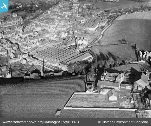
SPW019979 SCOTLAND (1927). Kirriemuir, general view, showing Gairie Works, Bellies Brae. An oblique aerial photograph taken facing north-east.
© Copyright OpenStreetMap contributors and licensed by the OpenStreetMap Foundation. 2026. Cartography is licensed as CC BY-SA.
Nearby Images (5)
SPW019979

SPW019980

SPW019983

SPW019982

SAR036871

Details
| Title | [SPW019979] Kirriemuir, general view, showing Gairie Works, Bellies Brae. An oblique aerial photograph taken facing north-east. |
| Reference | SPW019979 |
| Date | 1927 |
| Link | NRHE Collection item 1246377 |
| Place name | |
| Parish | KIRRIEMUIR |
| District | ANGUS |
| Country | SCOTLAND |
| Easting / Northing | 338602, 753795 |
| Longitude / Latitude | -3.0020220113362, 56.672012170526 |
| National Grid Reference | NO386538 |
Pins
Be the first to add a comment to this image!