
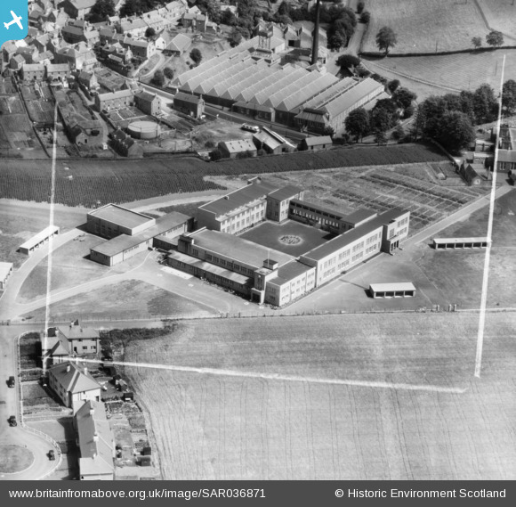
SAR036871 SCOTLAND (1959). Webster's Secondary School Kirriemuir, Angus, Scotland. An oblique aerial photograph taken facing North. This image was marked by AeroPictorial Ltd for photo editing.
© Copyright OpenStreetMap contributors and licensed by the OpenStreetMap Foundation. 2026. Cartography is licensed as CC BY-SA.
Nearby Images (3)
SAR036871

SPW019979

SPW019980

Details
| Title | [SAR036871] Webster's Secondary School Kirriemuir, Angus, Scotland. An oblique aerial photograph taken facing North. This image was marked by AeroPictorial Ltd for photo editing. |
| Reference | SAR036871 |
| Date | 1959 |
| Link | NRHE Collection item 1438692 |
| Place name | |
| Parish | KIRRIEMUIR |
| District | ANGUS |
| Country | SCOTLAND |
| Easting / Northing | 338404, 753658 |
| Longitude / Latitude | -3.0052200575965, 56.670755410669 |
| National Grid Reference | NO384537 |
Pins

Billy Turner |
Monday 20th of June 2016 07:31:13 PM | |
|
Billy Turner |
Monday 20th of June 2016 07:12:44 PM |

