
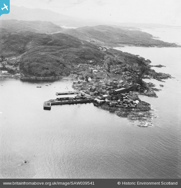
SAW039541 SCOTLAND (1951). Mallaig, general view. An oblique aerial photograph taken facing south. This image has been produced from a print.
© Copyright OpenStreetMap contributors and licensed by the OpenStreetMap Foundation. 2026. Cartography is licensed as CC BY-SA.
Nearby Images (3)
SAW039541

SAW039542

SAW039543

Details
| Title | [SAW039541] Mallaig, general view. An oblique aerial photograph taken facing south. This image has been produced from a print. |
| Reference | SAW039541 |
| Date | 1951 |
| Link | NRHE Collection item 1315314 |
| Place name | |
| Parish | GLENELG (LOCHABER) |
| District | LOCHABER |
| Country | SCOTLAND |
| Easting / Northing | 167585, 797072 |
| Longitude / Latitude | -5.8280747873978, 57.006324067172 |
| National Grid Reference | NM676971 |
Pins
Be the first to add a comment to this image!