
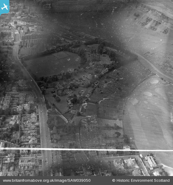
SAW039050 SCOTLAND (1951). Edinburgh, general view, showing St Leonard's Hall, Holyrood Park Road and Salisbury Green, Dalkeith Road. An oblique aerial photograph taken facing north. This image has been produced from a damaged and crop marked negative.
© Copyright OpenStreetMap contributors and licensed by the OpenStreetMap Foundation. 2026. Cartography is licensed as CC BY-SA.
Nearby Images (7)
SAW039045

SAW039050

SAW039044

SAW039046

SAW039047

SAW039048

SAW039049

Details
| Title | [SAW039050] Edinburgh, general view, showing St Leonard's Hall, Holyrood Park Road and Salisbury Green, Dalkeith Road. An oblique aerial photograph taken facing north. This image has been produced from a damaged and crop marked negative. |
| Reference | SAW039050 |
| Date | 1951 |
| Link | NRHE Collection item 1297643 |
| Place name | |
| Parish | EDINBURGH (EDINBURGH, CITY OF) |
| District | CITY OF EDINBURGH |
| Country | SCOTLAND |
| Easting / Northing | 326980, 672340 |
| Longitude / Latitude | -3.1690870342585, 55.938599526196 |
| National Grid Reference | NT270723 |
Pins
Be the first to add a comment to this image!