
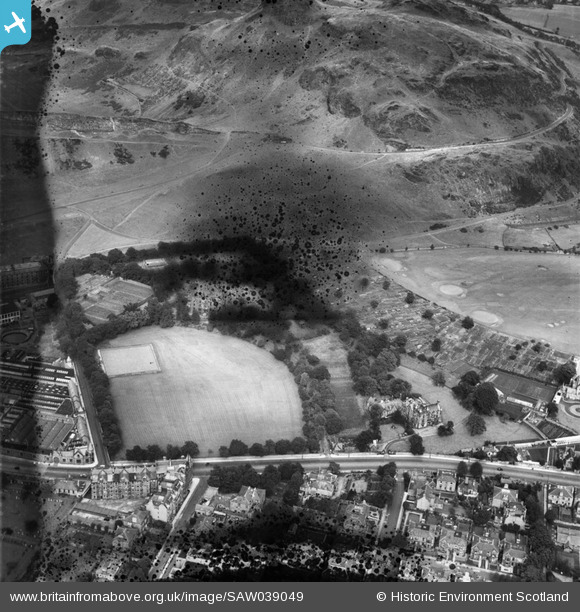
SAW039049 SCOTLAND (1951). Edinburgh, general view, showing Salisbury Green, Dalkeith Road and Nether Hill. An oblique aerial photograph taken facing north-east. This image has been produced from a damaged and crop marked negative.
© Copyright OpenStreetMap contributors and licensed by the OpenStreetMap Foundation. 2026. Cartography is licensed as CC BY-SA.
Nearby Images (7)
SAW039049

SAW039046

SAW039045

SAW039050

SAW039047

SAW039048

SAW039044

Details
| Title | [SAW039049] Edinburgh, general view, showing Salisbury Green, Dalkeith Road and Nether Hill. An oblique aerial photograph taken facing north-east. This image has been produced from a damaged and crop marked negative. |
| Reference | SAW039049 |
| Date | 1951 |
| Link | NRHE Collection item 1297642 |
| Place name | |
| Parish | EDINBURGH (EDINBURGH, CITY OF) |
| District | CITY OF EDINBURGH |
| Country | SCOTLAND |
| Easting / Northing | 327030, 672500 |
| Longitude / Latitude | -3.1683299666008, 55.940044552519 |
| National Grid Reference | NT270725 |
Pins

roger freeman |
Thursday 30th of August 2012 12:08:19 AM | |
|
roger freeman |
Thursday 30th of August 2012 12:00:53 AM | |
|
roger freeman |
Wednesday 29th of August 2012 11:58:34 PM | |
|
roger freeman |
Wednesday 29th of August 2012 11:57:15 PM | |
|
roger freeman |
Wednesday 29th of August 2012 11:54:58 PM | |
|
roger freeman |
Wednesday 29th of August 2012 11:53:23 PM | |
|
roger freeman |
Wednesday 29th of August 2012 11:21:40 PM | |
|
roger freeman |
Wednesday 29th of August 2012 11:20:02 PM | |
|
roger freeman |
Wednesday 29th of August 2012 11:19:15 PM | |
|
roger freeman |
Wednesday 29th of August 2012 11:17:14 PM | |
|
roger freeman |
Wednesday 29th of August 2012 11:07:53 PM | |
|
roger freeman |
Wednesday 29th of August 2012 11:05:23 PM |
User Comment Contributions
I collected spent bullets at the firing range 1960ish.I was going to make lead weights for fishing,but I was a hopeless angler and abandoned the project. John F |
JohnF |
Tuesday 23rd of October 2012 08:21:36 PM |