
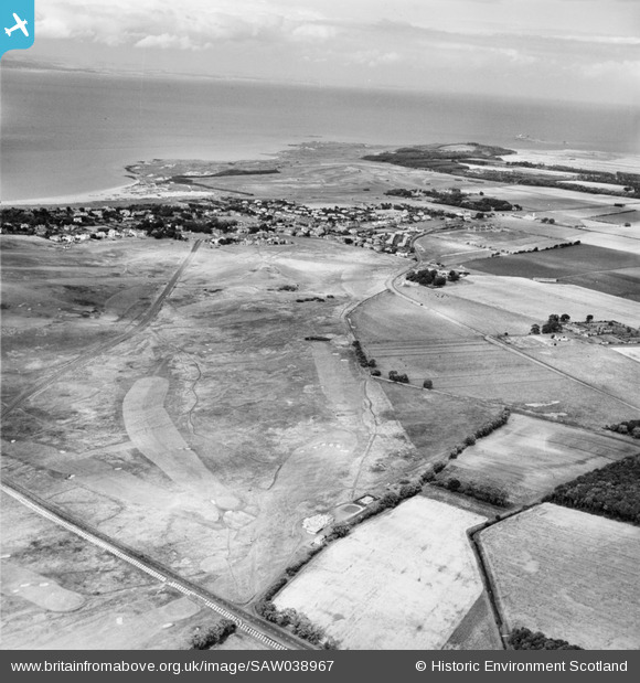
SAW038967 SCOTLAND (1951). Gullane Golf Course. An oblique aerial photograph taken facing north.
© Copyright OpenStreetMap contributors and licensed by the OpenStreetMap Foundation. 2026. Cartography is licensed as CC BY-SA.
Nearby Images (2)
SAW038967

SAW038965

Details
| Title | [SAW038967] Gullane Golf Course. An oblique aerial photograph taken facing north. |
| Reference | SAW038967 |
| Date | 1951 |
| Link | NRHE Collection item 1269891 |
| Place name | |
| Parish | DIRLETON |
| District | EAST LOTHIAN |
| Country | SCOTLAND |
| Easting / Northing | 348000, 682000 |
| Longitude / Latitude | -2.8344613602301, 56.028126124423 |
| National Grid Reference | NT480820 |
Pins
User Comment Contributions

WWII Anti Tank Blocks. |

cptpies |
Friday 10th of January 2014 01:12:47 PM |