
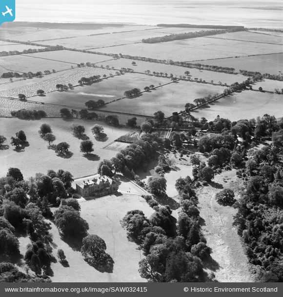
SAW032415 SCOTLAND (1950). Caulkerbush, general view, showing Southwick House and Walled Garden. An oblique aerial photograph taken facing south.
© Copyright OpenStreetMap contributors and licensed by the OpenStreetMap Foundation. 2025. Cartography is licensed as CC BY-SA.
Nearby Images (15)
SAW032415

SAW032417

SAW032398

SAW032399

SAW032404

SAW032405

SAW032410

SAW032411

SAW032412

SAW032413

SAW032414

SAW032416

SAW032418

SAW032403

SAW032419

Details
| Title | [SAW032415] Caulkerbush, general view, showing Southwick House and Walled Garden. An oblique aerial photograph taken facing south. |
| Reference | SAW032415 |
| Date | 1950 |
| Link | NRHE Collection item 1269803 |
| Place name | |
| Parish | COLVEND AND SOUTHWICK |
| District | STEWARTRY |
| Country | SCOTLAND |
| Easting / Northing | 292946, 557223 |
| Longitude / Latitude | -3.6695577212896, 54.898166444037 |
| National Grid Reference | NX929572 |
Pins
Be the first to add a comment to this image!