
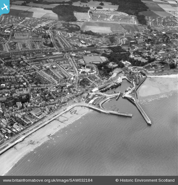
SAW032184 SCOTLAND (1950). Kirkcaldy, general view, showing Kirkcaldy Harbour and Smeaton. An oblique aerial photograph taken facing north.
© Copyright OpenStreetMap contributors and licensed by the OpenStreetMap Foundation. 2026. Cartography is licensed as CC BY-SA.
Nearby Images (7)
SAW032184

SAW032183

SAW032185

SAR016800

SPW027211

SPW027394

SAW032187

Details
| Title | [SAW032184] Kirkcaldy, general view, showing Kirkcaldy Harbour and Smeaton. An oblique aerial photograph taken facing north. |
| Reference | SAW032184 |
| Date | 1950 |
| Link | NRHE Collection item 1269748 |
| Place name | |
| Parish | KIRKCALDY AND DYSART |
| District | KIRKCALDY |
| Country | SCOTLAND |
| Easting / Northing | 328363, 691944 |
| Longitude / Latitude | -3.1521834021064, 56.11492794052 |
| National Grid Reference | NT284919 |
Pins

Bill Malcolm |
Friday 7th of April 2017 11:05:12 PM | |
|
Andrew |
Saturday 17th of October 2015 11:48:37 PM |