
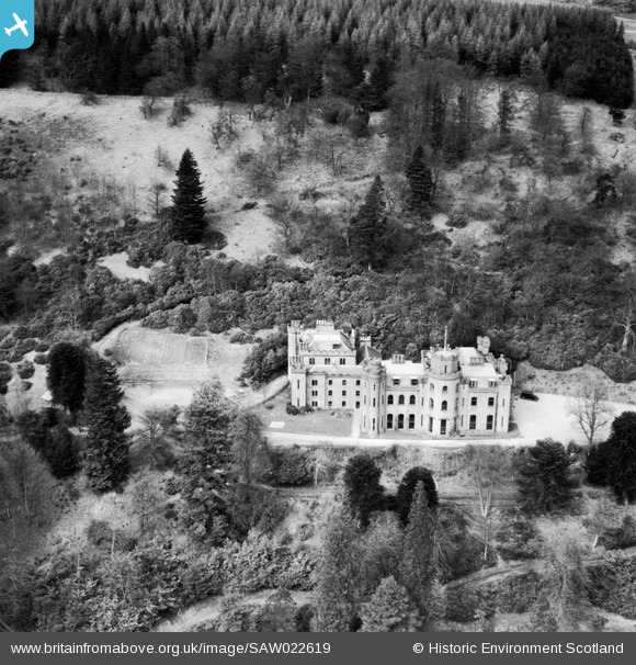
SAW022619 SCOTLAND (1949). Drumtochty Castle, Auchenblae. An oblique aerial photograph taken facing north.
© Copyright OpenStreetMap contributors and licensed by the OpenStreetMap Foundation. 2026. Cartography is licensed as CC BY-SA.
Nearby Images (4)
SAW022619

SAW022620

SAW022621

SAW022622

Details
| Title | [SAW022619] Drumtochty Castle, Auchenblae. An oblique aerial photograph taken facing north. |
| Reference | SAW022619 |
| Date | 1949 |
| Link | NRHE Collection item 1269201 |
| Place name | |
| Parish | FORDOUN |
| District | KINCARDINE AND DEESIDE |
| Country | SCOTLAND |
| Easting / Northing | 369984, 780047 |
| Longitude / Latitude | -2.4929811390424, 56.910934304492 |
| National Grid Reference | NO700800 |
Pins

Billy Turner |
Thursday 10th of March 2016 11:46:36 AM |
