
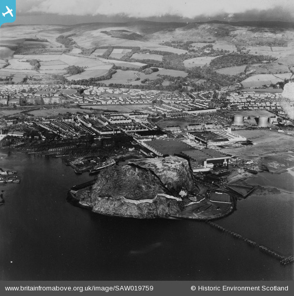
SAW019759 SCOTLAND (1948). Dumbarton, general view, showing Dumbarton Rock and Glasgow Road. An oblique aerial photograph taken facing north-east. This image has been produced from a print.
© Copyright OpenStreetMap contributors and licensed by the OpenStreetMap Foundation. 2026. Cartography is licensed as CC BY-SA.
Nearby Images (3)
SAW019759

SAW019760

SAW019758

Details
| Title | [SAW019759] Dumbarton, general view, showing Dumbarton Rock and Glasgow Road. An oblique aerial photograph taken facing north-east. This image has been produced from a print. |
| Reference | SAW019759 |
| Date | 1948 |
| Link | NRHE Collection item 1315070 |
| Place name | |
| Parish | DUMBARTON |
| District | DUMBARTON |
| Country | SCOTLAND |
| Easting / Northing | 240370, 674880 |
| Longitude / Latitude | -4.5561286798769, 55.940454633562 |
| National Grid Reference | NS404749 |
Pins
Be the first to add a comment to this image!