
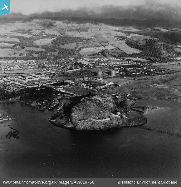
SAW019758 SCOTLAND (1948). Dumbarton, general view, showing Dumbarton Rock and Glasgow Road. An oblique aerial photograph taken facing east. This image has been produced from a print.
© Copyright OpenStreetMap contributors and licensed by the OpenStreetMap Foundation. 2026. Cartography is licensed as CC BY-SA.
Nearby Images (3)
SAW019758

SAW019760

SAW019759

Details
| Title | [SAW019758] Dumbarton, general view, showing Dumbarton Rock and Glasgow Road. An oblique aerial photograph taken facing east. This image has been produced from a print. |
| Reference | SAW019758 |
| Date | 1948 |
| Link | NRHE Collection item 1315069 |
| Place name | |
| Parish | DUMBARTON |
| District | DUMBARTON |
| Country | SCOTLAND |
| Easting / Northing | 240270, 674640 |
| Longitude / Latitude | -4.5575861159109, 55.938266971818 |
| National Grid Reference | NS403746 |
Pins

mannidaze |
Sunday 20th of January 2019 05:13:43 PM | |
|
mannidaze |
Wednesday 12th of November 2014 05:59:28 PM |