
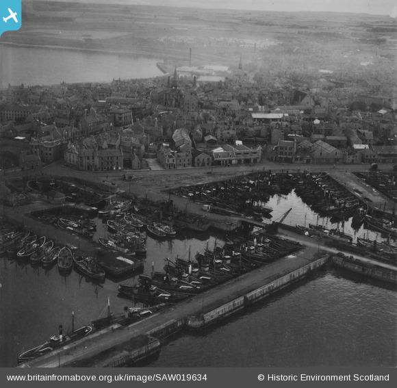
SAW019634 SCOTLAND (1948). Peterhead, general view, showing Port Henry and North Harbours and Town House, Broad Street. An oblique aerial photograph taken facing west. This image has been produced from a print.
© Copyright OpenStreetMap contributors and licensed by the OpenStreetMap Foundation. 2026. Cartography is licensed as CC BY-SA.
Nearby Images (11)
SAW019634

SAW014820

SAW014821

SAW014824

SAW019631

SAW014823

SAW019635

SAW014819

SAW014822

SAW014825

SAW019632

Details
| Title | [SAW019634] Peterhead, general view, showing Port Henry and North Harbours and Town House, Broad Street. An oblique aerial photograph taken facing west. This image has been produced from a print. |
| Reference | SAW019634 |
| Date | 1948 |
| Link | NRHE Collection item 1315007 |
| Place name | |
| Parish | PETERHEAD |
| District | BANFF AND BUCHAN |
| Country | SCOTLAND |
| Easting / Northing | 413610, 846130 |
| Longitude / Latitude | -1.7728491413634, 57.505391360535 |
| National Grid Reference | NK136461 |
Pins
Be the first to add a comment to this image!