
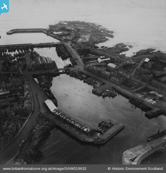
SAW019632 SCOTLAND (1948). North and South Harbours, Peterhead. An oblique aerial photograph taken facing north-east. This image has been produced from a print.
© Copyright OpenStreetMap contributors and licensed by the OpenStreetMap Foundation. 2026. Cartography is licensed as CC BY-SA.
Nearby Images (5)
SAW014825

SAW019632

SAW014822

SAW014819

SAW019634

Details
| Title | [SAW019632] North and South Harbours, Peterhead. An oblique aerial photograph taken facing north-east. This image has been produced from a print. |
| Reference | SAW019632 |
| Date | 1948 |
| Link | NRHE Collection item 1315005 |
| Place name | |
| Parish | MARITIME - ABERDEENSHIRE |
| District | MARITIME |
| Country | SCOTLAND |
| Easting / Northing | 413700, 845940 |
| Longitude / Latitude | -1.7713577284074, 57.503681782795 |
| National Grid Reference | NK137459 |
Pins

Matt Aldred edob.mattaldred.com |
Thursday 4th of March 2021 03:15:35 PM | |

redmist |
Saturday 30th of January 2021 10:16:06 AM |