
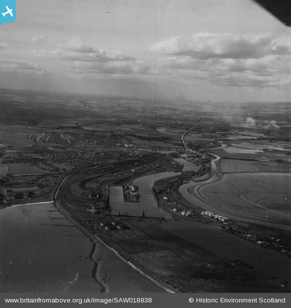
SAW018838 SCOTLAND (1948). Grangemouth, general view, showing Grange Dock and Forth and Clyde Canal. An oblique aerial photograph taken facing west. This image has been produced from a print.
© Copyright OpenStreetMap contributors and licensed by the OpenStreetMap Foundation. 2026. Cartography is licensed as CC BY-SA.
Nearby Images (5)
SAR014802

SAR014803

SAR014804

SAW018838

SPW017723

Details
| Title | [SAW018838] Grangemouth, general view, showing Grange Dock and Forth and Clyde Canal. An oblique aerial photograph taken facing west. This image has been produced from a print. |
| Reference | SAW018838 |
| Date | 1948 |
| Link | NRHE Collection item 1314880 |
| Place name | |
| Parish | GRANGEMOUTH |
| District | FALKIRK |
| Country | SCOTLAND |
| Easting / Northing | 294232, 682801 |
| Longitude / Latitude | -3.6972923393621, 56.026470162189 |
| National Grid Reference | NS942828 |
Pins
Be the first to add a comment to this image!