
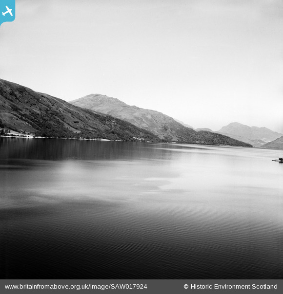
SAW017924 SCOTLAND (1948). Loch Lomond, general view, showing Stob Gobhlach. An oblique aerial photograph taken facing north-west.
© Copyright OpenStreetMap contributors and licensed by the OpenStreetMap Foundation. 2025. Cartography is licensed as CC BY-SA.
Nearby Images (2)
SAW017924

SAW017922

Details
| Title | [SAW017924] Loch Lomond, general view, showing Stob Gobhlach. An oblique aerial photograph taken facing north-west. |
| Reference | SAW017924 |
| Date | 1948 |
| Link | NRHE Collection item 1269104 |
| Place name | |
| Parish | LUSS |
| District | DUMBARTON |
| Country | SCOTLAND |
| Easting / Northing | 234550, 697930 |
| Longitude / Latitude | -4.6634371141035, 56.145384602156 |
| National Grid Reference | NS346979 |
Pins
Be the first to add a comment to this image!
User Comment Contributions
A perfect view. |

Class31 |
Sunday 7th of April 2013 09:42:25 PM |