
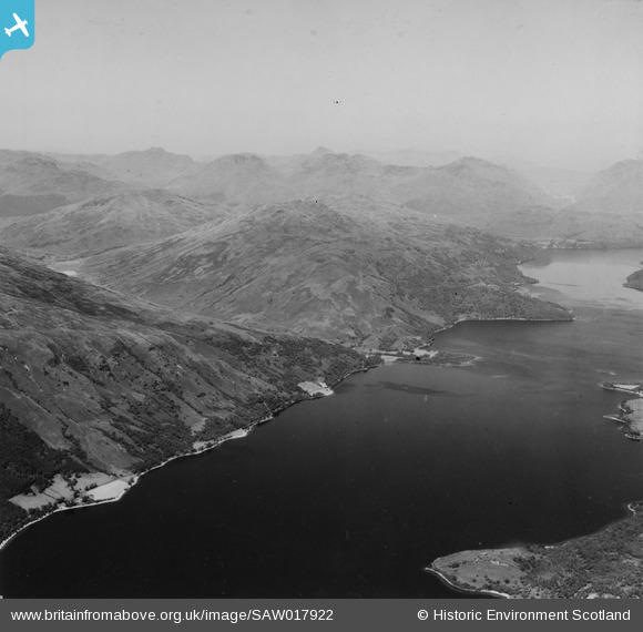
SAW017922 SCOTLAND (1948). Loch Lomond, general view, showing Inverbeg and Stob Gobhlach. An oblique aerial photograph taken facing north-west. This image has been produced from a print.
© Copyright OpenStreetMap contributors and licensed by the OpenStreetMap Foundation. 2025. Cartography is licensed as CC BY-SA.
Nearby Images (3)
SAW017922

SAW017924

SAW017914

Details
| Title | [SAW017922] Loch Lomond, general view, showing Inverbeg and Stob Gobhlach. An oblique aerial photograph taken facing north-west. This image has been produced from a print. |
| Reference | SAW017922 |
| Date | 1948 |
| Link | NRHE Collection item 1314850 |
| Place name | |
| Parish | ARROCHAR |
| District | DUMBARTON |
| Country | SCOTLAND |
| Easting / Northing | 234430, 698020 |
| Longitude / Latitude | -4.6654224818726, 56.146150799127 |
| National Grid Reference | NS344980 |
Pins

Billy Turner |
Monday 22nd of June 2015 11:20:10 PM | |
|
Billy Turner |
Monday 22nd of June 2015 11:14:03 PM | |
|
Billy Turner |
Monday 22nd of June 2015 11:08:22 PM | |
|
Billy Turner |
Monday 22nd of June 2015 11:01:09 PM | |
|
Billy Turner |
Monday 22nd of June 2015 10:56:35 PM |
