
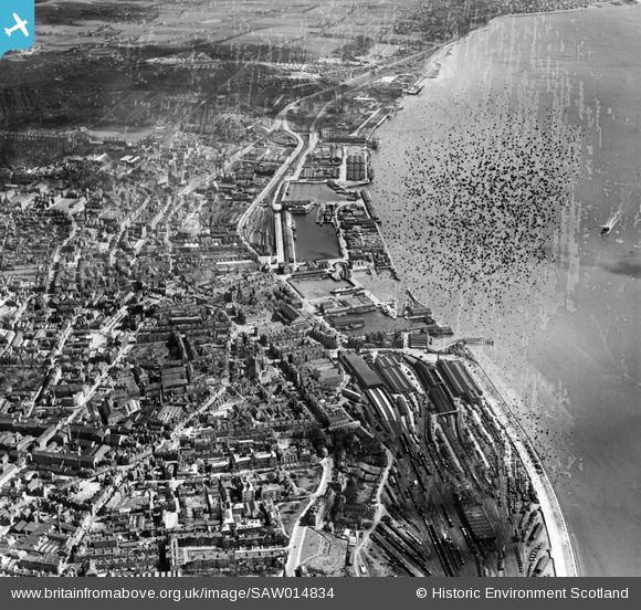
SAW014834 SCOTLAND (1948). Dundee, general view, showing Dundee Station and Docks. An oblique aerial photograph taken facing east. This image has been produced from a damaged negative.
© Copyright OpenStreetMap contributors and licensed by the OpenStreetMap Foundation. 2026. Cartography is licensed as CC BY-SA.
Nearby Images (12)
SAW009806

SAW014834

SPW022108

SPW022103

SPW019936

SAW019552

SPW022110

SAW019549

SPW040570

SPW022109

SPW022111

SAW019550

Details
| Title | [SAW014834] Dundee, general view, showing Dundee Station and Docks. An oblique aerial photograph taken facing east. This image has been produced from a damaged negative. |
| Reference | SAW014834 |
| Date | 1948 |
| Link | NRHE Collection item 1268927 |
| Place name | |
| Parish | DUNDEE (DUNDEE, CITY OF) |
| District | CITY OF DUNDEE |
| Country | SCOTLAND |
| Easting / Northing | 340743, 730201 |
| Longitude / Latitude | -2.9616931403061, 56.460328117161 |
| National Grid Reference | NO407302 |
Pins
User Comment Contributions
Caption should read Dundee stations (ie lower case 's' at start of word and plural)as Dundee West, Taybridge and Dundee East stations are all visible. |

DaveC |
Friday 12th of April 2013 11:48:31 PM |