
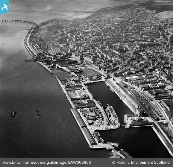
SAW009806 SCOTLAND (1947). Dundee, general view, showing the Docks and Tay Bridge. An oblique aerial photograph taken facing west.
© Copyright OpenStreetMap contributors and licensed by the OpenStreetMap Foundation. 2026. Cartography is licensed as CC BY-SA.
Nearby Images (12)
SAW009806

SAW014834

SPW022108

SPW022103

SPW019936

SAW019552

SPW022110

SAW019549

SPW040570

SPW022109

SPW022111

SAW019550

Details
| Title | [SAW009806] Dundee, general view, showing the Docks and Tay Bridge. An oblique aerial photograph taken facing west. |
| Reference | SAW009806 |
| Date | 1947 |
| Link | NRHE Collection item 1268649 |
| Place name | |
| Parish | DUNDEE (DUNDEE, CITY OF) |
| District | CITY OF DUNDEE |
| Country | SCOTLAND |
| Easting / Northing | 340743, 730201 |
| Longitude / Latitude | -2.9616931403061, 56.460328117161 |
| National Grid Reference | NO407302 |
Pins

Kris |
Friday 9th of February 2024 08:21:53 PM | |

Finchleyflyer |
Tuesday 4th of December 2012 04:00:20 PM |