
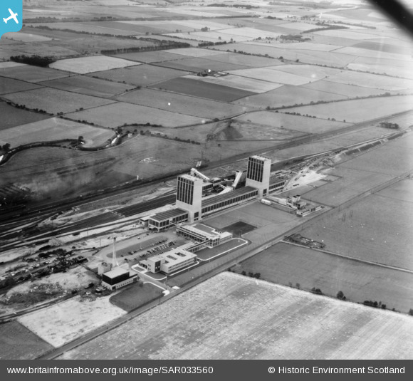
SAR033560 SCOTLAND (1958). NCB Thornton Kirkcaldy and Dysart, Fife, Scotland. An oblique aerial photograph taken facing South.
© Copyright OpenStreetMap contributors and licensed by the OpenStreetMap Foundation. 2026. Cartography is licensed as CC BY-SA.
Nearby Images (5)
SAR021218

SAR021219

SAR021220

SAR033560

SAR033561

Details
| Title | [SAR033560] NCB Thornton Kirkcaldy and Dysart, Fife, Scotland. An oblique aerial photograph taken facing South. |
| Reference | SAR033560 |
| Date | 1958 |
| Link | NRHE Collection item 1438632 |
| Place name | |
| Parish | KIRKCALDY AND DYSART |
| District | KIRKCALDY |
| Country | SCOTLAND |
| Easting / Northing | 328050, 697260 |
| Longitude / Latitude | -3.1586520483651, 56.162638285285 |
| National Grid Reference | NT281973 |
Pins

Norman |
Wednesday 13th of January 2021 10:23:09 PM |
User Comment Contributions
Rothes Colliery. |

Class31 |
Monday 15th of September 2014 11:15:23 PM |