
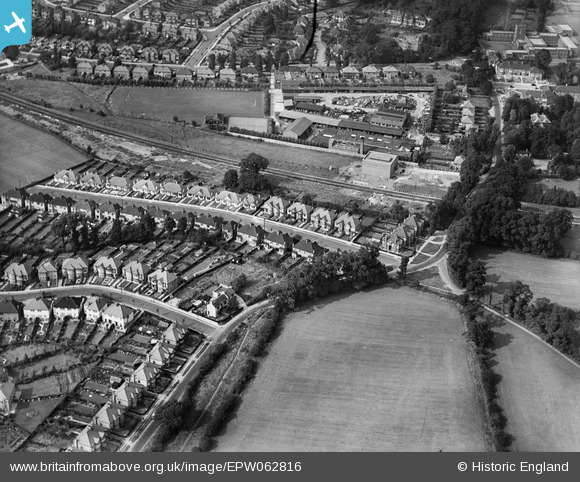
EPW062816 ENGLAND (1939). Longfield Avenue and environs, Mill Hill, 1939
© Copyright OpenStreetMap contributors and licensed by the OpenStreetMap Foundation. 2026. Cartography is licensed as CC BY-SA.
Nearby Images (10)
EPW062816

EPW062813

EPW062818

EPW062810

EPW062815

EPW062819

EPW010851

EPW062811

EPW062809

EPW062817

Details
| Title | [EPW062816] Longfield Avenue and environs, Mill Hill, 1939 |
| Reference | EPW062816 |
| Date | 30-August-1939 |
| Link | |
| Place name | MILL HILL |
| Parish | |
| District | |
| Country | ENGLAND |
| Easting / Northing | 522354, 191078 |
| Longitude / Latitude | -0.23301081173024, 51.604758161376 |
| National Grid Reference | TQ224911 |
Pins
Be the first to add a comment to this image!