
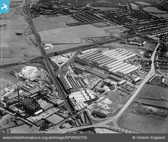
EPW062730 ENGLAND (1939). The Everite Asbestos Cement Works, Farnworth, 1939
© Copyright OpenStreetMap contributors and licensed by the OpenStreetMap Foundation. 2026. Cartography is licensed as CC BY-SA.
Nearby Images (20)
EPW062730

EPW062728

EPW062731

EPW045816

EPW019342

EPW045813

EPW045815

EPW019341

EPW045814

EPW045817

EPW045819

EPW045818

EPW062733

EPW019344

EPW019345

EPW062729

EPW062732

EPW019347

EPW019346

EPW019343

Details
| Title | [EPW062730] The Everite Asbestos Cement Works, Farnworth, 1939 |
| Reference | EPW062730 |
| Date | 16-August-1939 |
| Link | |
| Place name | FARNWORTH |
| Parish | |
| District | |
| Country | ENGLAND |
| Easting / Northing | 352286, 387553 |
| Longitude / Latitude | -2.7174065729114, 53.382403626153 |
| National Grid Reference | SJ523876 |
Pins

Focal point |
Sunday 31st of March 2024 02:03:54 AM | |

Ginger79 |
Tuesday 17th of May 2016 12:34:57 PM | |
|
Ginger79 |
Tuesday 17th of May 2016 12:33:24 PM | |
|
Ginger79 |
Saturday 1st of November 2014 03:21:42 PM | |
|
Ginger79 |
Saturday 1st of November 2014 03:20:31 PM | |
|
totoro |
Wednesday 28th of August 2013 10:20:49 PM |


