
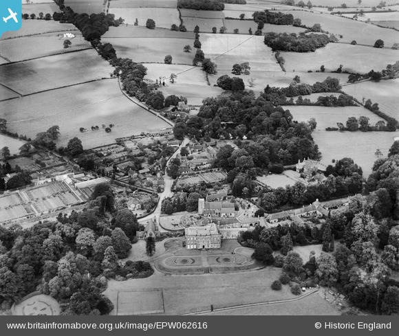
EPW062616 ENGLAND (1939). The village, Swynnerton, 1939. This image has been produced from a damaged negative.
© Copyright OpenStreetMap contributors and licensed by the OpenStreetMap Foundation. 2026. Cartography is licensed as CC BY-SA.
Nearby Images (5)
EPW062616

EPW062617

EPW062619

EPW062618

EPW062622

Details
| Title | [EPW062616] The village, Swynnerton, 1939. This image has been produced from a damaged negative. |
| Reference | EPW062616 |
| Date | 11-August-1939 |
| Link | |
| Place name | SWYNNERTON |
| Parish | SWYNNERTON |
| District | |
| Country | ENGLAND |
| Easting / Northing | 385223, 335650 |
| Longitude / Latitude | -2.2197933908374, 52.917748367256 |
| National Grid Reference | SJ852357 |
Pins
Be the first to add a comment to this image!