
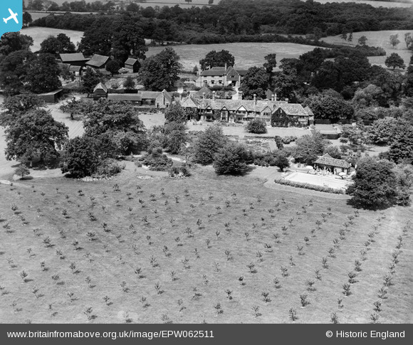
EPW062511 ENGLAND (1939). Ellens Manor, Ellen's Green, 1939
© Copyright OpenStreetMap contributors and licensed by the OpenStreetMap Foundation. 2025. Cartography is licensed as CC BY-SA.
Nearby Images (5)
EPW062511

EPW062510

EPW062512

EPW062509

EPW062505

Details
| Title | [EPW062511] Ellens Manor, Ellen's Green, 1939 |
| Reference | EPW062511 |
| Date | 13-August-1939 |
| Link | |
| Place name | ELLEN'S GREEN |
| Parish | EWHURST |
| District | |
| Country | ENGLAND |
| Easting / Northing | 510468, 135384 |
| Longitude / Latitude | -0.42188927198624, 51.106567137105 |
| National Grid Reference | TQ105354 |
Pins
Be the first to add a comment to this image!