
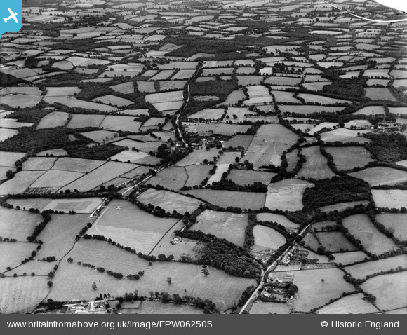
EPW062505 ENGLAND (1939). The village and surrounding countryside, Ellen's Green, 1939
© Copyright OpenStreetMap contributors and licensed by the OpenStreetMap Foundation. 2025. Cartography is licensed as CC BY-SA.
Nearby Images (5)
EPW062505

EPW062509

EPW062511

EPW062510

EPW062512

Details
| Title | [EPW062505] The village and surrounding countryside, Ellen's Green, 1939 |
| Reference | EPW062505 |
| Date | 13-August-1939 |
| Link | |
| Place name | ELLEN'S GREEN |
| Parish | EWHURST |
| District | |
| Country | ENGLAND |
| Easting / Northing | 510293, 135343 |
| Longitude / Latitude | -0.42440078719655, 51.106232266016 |
| National Grid Reference | TQ103353 |
Pins

Will Wallace |
Saturday 24th of May 2014 03:50:38 PM |