
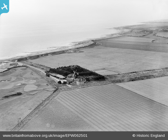
EPW062501 ENGLAND (1939). The Mill House Windmill and the surrounding coastline, Climping, from the north-east, 1939
© Copyright OpenStreetMap contributors and licensed by the OpenStreetMap Foundation. 2026. Cartography is licensed as CC BY-SA.
Nearby Images (7)
EPW062501

EPW062499

EPW062502

EAW046500

EPW062500

EAW046502

EAW046501

Details
| Title | [EPW062501] The Mill House Windmill and the surrounding coastline, Climping, from the north-east, 1939 |
| Reference | EPW062501 |
| Date | 13-August-1939 |
| Link | |
| Place name | CLIMPING |
| Parish | CLIMPING |
| District | |
| Country | ENGLAND |
| Easting / Northing | 501596, 101263 |
| Longitude / Latitude | -0.55811246133356, 50.801444655262 |
| National Grid Reference | TQ016013 |
Pins
User Comment Contributions

The shortened mill today |

totoro |
Monday 9th of September 2013 10:09:22 PM |