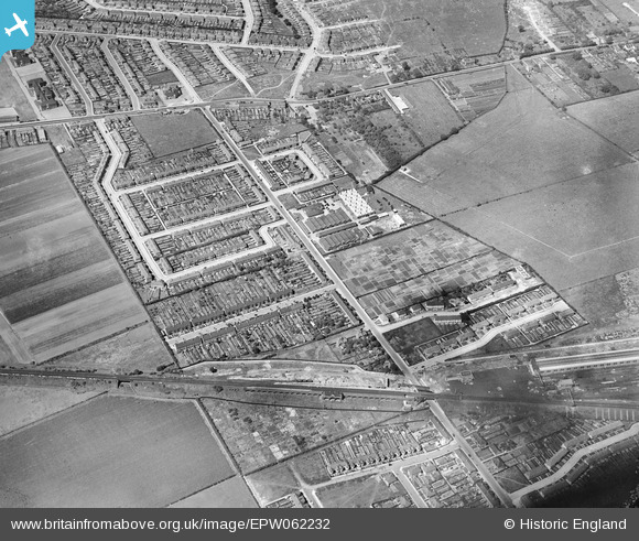
EPW062232 ENGLAND (1939). New North Road and environs, Fairlop, 1939
© Copyright OpenStreetMap contributors and licensed by the OpenStreetMap Foundation. 2026. Cartography is licensed as CC BY-SA.
Nearby Images (5)
Details
| Title | [EPW062232] New North Road and environs, Fairlop, 1939 |
| Reference | EPW062232 |
| Date | 25-July-1939 |
| Link | |
| Place name | FAIRLOP |
| Parish | |
| District | |
| Country | ENGLAND |
| Easting / Northing | 544813, 191439 |
| Longitude / Latitude | 0.091267894359708, 51.60267424295 |
| National Grid Reference | TQ448914 |
Pins

Jenny Karling |
Friday 29th of May 2015 06:53:50 PM | |

brian |
Monday 8th of December 2014 01:21:34 PM | |

Maurice |
Thursday 5th of September 2013 10:44:39 PM | |

Jenny Karling |
Thursday 5th of September 2013 07:18:39 PM |


![[EPW062232] New North Road and environs, Fairlop, 1939](http://britainfromabove.org.uk/sites/all/libraries/aerofilms-images/public/100x100/EPW/062/EPW062232.jpg)
![[EPW062234] Henry Hughes and Son Husun Nautical Instrument Works, Fairlop, 1939](http://britainfromabove.org.uk/sites/all/libraries/aerofilms-images/public/100x100/EPW/062/EPW062234.jpg)
![[EPW062242] Henry Hughes and Son Husun Nautical Instrument Works, Fairlop, 1939](http://britainfromabove.org.uk/sites/all/libraries/aerofilms-images/public/100x100/EPW/062/EPW062242.jpg)
![[EPW062233] New North Road and environs, Fairlop, 1939](http://britainfromabove.org.uk/sites/all/libraries/aerofilms-images/public/100x100/EPW/062/EPW062233.jpg)
![[EPW062241] Henry Hughes and Son Husun Nautical Instrument Works, Fairlop, 1939](http://britainfromabove.org.uk/sites/all/libraries/aerofilms-images/public/100x100/EPW/062/EPW062241.jpg)