
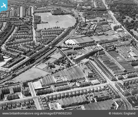
EPW062163 ENGLAND (1939). The C.A.V.-Bosch Ltd Electrical Engineering Works and other factories, Acton, 1939
© Copyright OpenStreetMap contributors and licensed by the OpenStreetMap Foundation. 2026. Cartography is licensed as CC BY-SA.
Nearby Images (33)
EPW062163

EPW020849

EPW020848

EAW030998

EAW031004

EAW031000

EAW031001

EAW031002

EPW062161

EPW020852

EPW020846

EAW030997

EPW062158

EAW031003

EPW062160

EPW020856

EPW062162

EPW020850

EAW031006

EAW030999

EPW014096

EPW020847

EAW031005

EPW062164

EPW062159

EPW062165

EPW007147

EPW020855

EPW044578

EPW059950

EPW044639

EPW044640

EPW044643

Details
| Title | [EPW062163] The C.A.V.-Bosch Ltd Electrical Engineering Works and other factories, Acton, 1939 |
| Reference | EPW062163 |
| Date | 9-July-1939 |
| Link | |
| Place name | ACTON |
| Parish | |
| District | |
| Country | ENGLAND |
| Easting / Northing | 521161, 179766 |
| Longitude / Latitude | -0.25412890270742, 51.503341231129 |
| National Grid Reference | TQ212798 |
Pins

Leslie B |
Saturday 26th of March 2016 11:45:18 PM |