
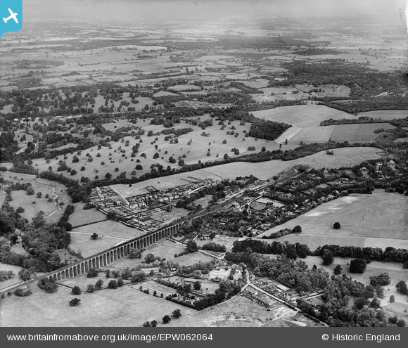
EPW062064 ENGLAND (1939). Lockleys Park and High Welwyn, Welwyn, from the south-east, 1939
© Copyright OpenStreetMap contributors and licensed by the OpenStreetMap Foundation. 2026. Cartography is licensed as CC BY-SA.
Nearby Images (5)
EPW062064

EPW025361

EPW062061

EPW054526

EPW062059

Details
| Title | [EPW062064] Lockleys Park and High Welwyn, Welwyn, from the south-east, 1939 |
| Reference | EPW062064 |
| Date | 28-June-1939 |
| Link | |
| Place name | WELWYN |
| Parish | WELWYN |
| District | |
| Country | ENGLAND |
| Easting / Northing | 524689, 215091 |
| Longitude / Latitude | -0.19071385709297, 51.820067901452 |
| National Grid Reference | TL247151 |
Pins

Chells809 |
Monday 21st of October 2013 09:44:36 PM | |
|
Chells809 |
Monday 21st of October 2013 09:41:45 PM | |
|
Chells809 |
Monday 21st of October 2013 09:38:39 PM | |
|
Chells809 |
Monday 21st of October 2013 09:35:45 PM | |
|
Chells809 |
Monday 21st of October 2013 09:34:24 PM | |
|
Chells809 |
Monday 21st of October 2013 09:33:09 PM |