
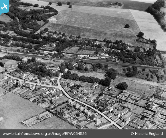
EPW054526 ENGLAND (1937). The village, Digswell, 1937
© Copyright OpenStreetMap contributors and licensed by the OpenStreetMap Foundation. 2026. Cartography is licensed as CC BY-SA.
Nearby Images (4)
EPW054526

EPW025361

EPW062064

EPW062061

Details
| Title | [EPW054526] The village, Digswell, 1937 |
| Reference | EPW054526 |
| Date | 30-July-1937 |
| Link | |
| Place name | DIGSWELL |
| Parish | WELWYN |
| District | |
| Country | ENGLAND |
| Easting / Northing | 524644, 215324 |
| Longitude / Latitude | -0.19128259250536, 51.822172036726 |
| National Grid Reference | TL246153 |
Pins

JCK |
Wednesday 25th of February 2015 08:29:55 PM | |
|
JCK |
Wednesday 25th of February 2015 08:28:12 PM | |
|
JCK |
Wednesday 25th of February 2015 08:26:58 PM | |
|
Chells809 |
Thursday 26th of June 2014 10:25:51 PM | |
|
Hugh Madgin |
Thursday 26th of December 2013 10:14:07 PM | |
Where the railway was on an embankment, such drops were not unusual, even away from the NE. There are traces of one at Bridgnorth on the Seven Valley Railway. |
John W |
Thursday 23rd of June 2016 08:08:53 PM |
|
Hugh Madgin |
Thursday 26th of December 2013 10:09:26 PM |