
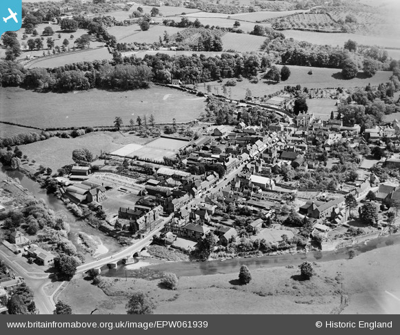
EPW061939 ENGLAND (1939). The town, Tenbury Wells, 1939
© Copyright OpenStreetMap contributors and licensed by the OpenStreetMap Foundation. 2026. Cartography is licensed as CC BY-SA.
Nearby Images (7)
EPW061939

EPW061938

EPW061725

EPW061727

EPW061726

EPW061723

EPW061724

Details
| Title | [EPW061939] The town, Tenbury Wells, 1939 |
| Reference | EPW061939 |
| Date | 10-June-1939 |
| Link | |
| Place name | TENBURY WELLS |
| Parish | TENBURY |
| District | |
| Country | ENGLAND |
| Easting / Northing | 359642, 268406 |
| Longitude / Latitude | -2.592058479622, 52.31189053448 |
| National Grid Reference | SO596684 |
Pins

MB |
Monday 9th of December 2013 04:42:53 PM | |
|
totoro |
Sunday 15th of September 2013 05:40:35 PM | |
|
totoro |
Sunday 15th of September 2013 05:37:34 PM | |
|
totoro |
Sunday 15th of September 2013 05:36:28 PM | |
|
totoro |
Sunday 15th of September 2013 05:36:11 PM | |
|
totoro |
Sunday 15th of September 2013 05:34:46 PM | |
|
totoro |
Sunday 15th of September 2013 05:32:30 PM | |

Class31 |
Sunday 25th of August 2013 10:31:02 AM |
User Comment Contributions
The main road leading away from us is headed just East of South |
totoro |
Sunday 15th of September 2013 05:34:16 PM |