
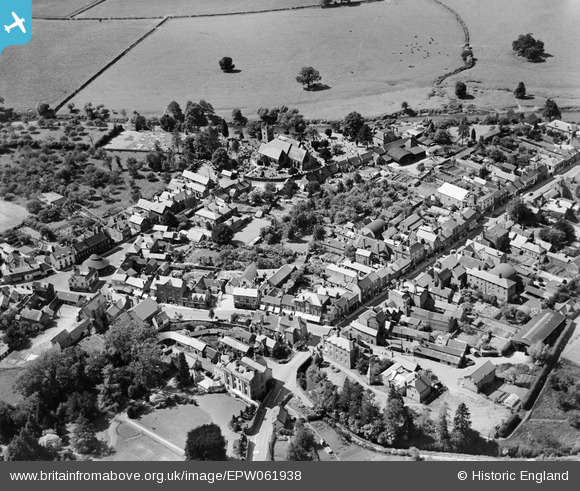
EPW061938 ENGLAND (1939). The town centre, Tenbury Wells, 1939
© Copyright OpenStreetMap contributors and licensed by the OpenStreetMap Foundation. 2026. Cartography is licensed as CC BY-SA.
Nearby Images (3)
EPW061938

EPW061939

EPW061725

Details
| Title | [EPW061938] The town centre, Tenbury Wells, 1939 |
| Reference | EPW061938 |
| Date | 10-June-1939 |
| Link | |
| Place name | TENBURY WELLS |
| Parish | TENBURY |
| District | |
| Country | ENGLAND |
| Easting / Northing | 359522, 268329 |
| Longitude / Latitude | -2.5938095327095, 52.311189408445 |
| National Grid Reference | SO595683 |
Pins

totoro |
Sunday 15th of September 2013 06:04:42 PM | |
|
totoro |
Sunday 15th of September 2013 06:03:48 PM | |
|
totoro |
Sunday 15th of September 2013 06:01:38 PM | |
|
totoro |
Sunday 15th of September 2013 06:00:12 PM | |
|
totoro |
Sunday 15th of September 2013 05:59:18 PM | |
|
totoro |
Sunday 15th of September 2013 05:59:01 PM | |
|
totoro |
Sunday 15th of September 2013 05:57:56 PM |