
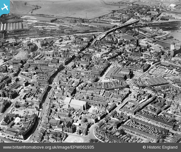
EPW061935 ENGLAND (1939). The town centre, Doncaster, 1939
© Copyright OpenStreetMap contributors and licensed by the OpenStreetMap Foundation. 2026. Cartography is licensed as CC BY-SA.
Nearby Images (12)
EPW061935

EPW012756

EPW012775

EPW061936

EPW012760

EPW012776

EPW012774

EPW061937

EPW012767

EPW012772

EPW012777

EPW061930

Details
| Title | [EPW061935] The town centre, Doncaster, 1939 |
| Reference | EPW061935 |
| Date | 6-July-1939 |
| Link | |
| Place name | DONCASTER |
| Parish | |
| District | |
| Country | ENGLAND |
| Easting / Northing | 457563, 403357 |
| Longitude / Latitude | -1.1316321610854, 53.523476341968 |
| National Grid Reference | SE576034 |
Pins

tolls |
Monday 9th of March 2026 10:48:50 AM | |
|
G |
Thursday 11th of April 2019 09:02:18 PM | |

Billy Turner |
Thursday 26th of November 2015 06:57:03 PM | |
|
John Wass |
Thursday 16th of October 2014 03:40:22 PM | |
|
John Wass |
Thursday 16th of October 2014 03:38:29 PM | |
|
Elliott |
Thursday 5th of June 2014 07:22:54 PM |

User Comment Contributions
I can just see the tree in my garden on the bottom right hand side of the image. The long tall building was Priestnalls ice cream factory. Agonisingly, my house is just outside the image. |
Elliott |
Thursday 5th of June 2014 07:05:37 PM |