
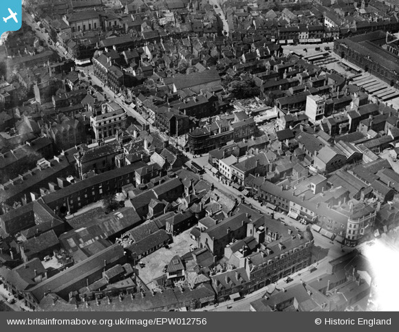
EPW012756 ENGLAND (1925). The High Street, Doncaster, 1925
© Copyright OpenStreetMap contributors and licensed by the OpenStreetMap Foundation. 2026. Cartography is licensed as CC BY-SA.
Nearby Images (11)
EPW012756

EPW061936

EPW061935

EPW012775

EPW012774

EPW012760

EPW012777

EPW012776

EPW061930

EPW012773

EPW012767

Details
| Title | [EPW012756] The High Street, Doncaster, 1925 |
| Reference | EPW012756 |
| Date | 15-May-1925 |
| Link | |
| Place name | DONCASTER |
| Parish | |
| District | |
| Country | ENGLAND |
| Easting / Northing | 457522, 403297 |
| Longitude / Latitude | -1.1322616116317, 53.522941528171 |
| National Grid Reference | SE575033 |
Pins

Brightonboy |
Thursday 26th of November 2015 08:11:07 PM | |

Billy Turner |
Thursday 26th of November 2015 05:37:10 PM | |

Class31 |
Monday 2nd of September 2013 10:38:54 PM | |
|
Class31 |
Monday 2nd of September 2013 10:38:03 PM | |
|
Class31 |
Monday 2nd of September 2013 10:36:53 PM | |
|
Class31 |
Monday 2nd of September 2013 10:36:35 PM | |
|
Class31 |
Monday 2nd of September 2013 10:35:41 PM |
