
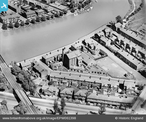
EPW061398 ENGLAND (1939). The Riverside Works on Gaskell Road, Lower Penwortham, 1939
© Copyright OpenStreetMap contributors and licensed by the OpenStreetMap Foundation. 2026. Cartography is licensed as CC BY-SA.
Nearby Images (4)
EPW061398

EPW061396

EPW061399

EPW061397

Details
| Title | [EPW061398] The Riverside Works on Gaskell Road, Lower Penwortham, 1939 |
| Reference | EPW061398 |
| Date | 2-June-1939 |
| Link | |
| Place name | LOWER PENWORTHAM |
| Parish | PENWORTHAM |
| District | |
| Country | ENGLAND |
| Easting / Northing | 353070, 428152 |
| Longitude / Latitude | -2.711719960711, 53.747405116632 |
| National Grid Reference | SD531282 |
Pins
Be the first to add a comment to this image!