
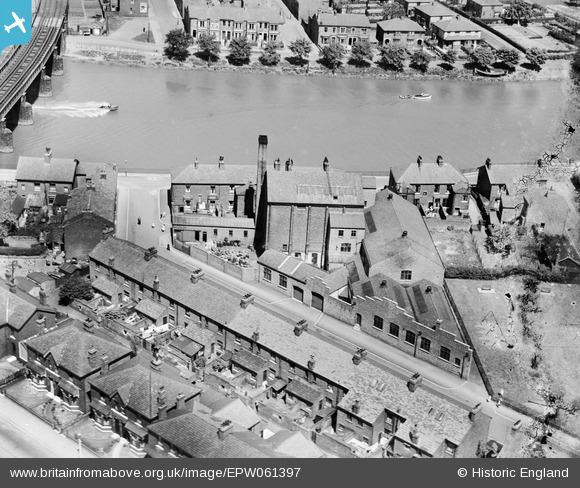
EPW061397 ENGLAND (1939). The Riverside Works on Gaskell Road, Lower Penwortham, 1939
© Copyright OpenStreetMap contributors and licensed by the OpenStreetMap Foundation. 2026. Cartography is licensed as CC BY-SA.
Nearby Images (4)
EPW061397

EPW061396

EPW061398

EPW061399

Details
| Title | [EPW061397] The Riverside Works on Gaskell Road, Lower Penwortham, 1939 |
| Reference | EPW061397 |
| Date | 2-June-1939 |
| Link | |
| Place name | LOWER PENWORTHAM |
| Parish | PENWORTHAM |
| District | |
| Country | ENGLAND |
| Easting / Northing | 353066, 428152 |
| Longitude / Latitude | -2.7117806178182, 53.747404756443 |
| National Grid Reference | SD531282 |
Pins

Matt Aldred edob.mattaldred.com |
Saturday 22nd of April 2023 05:52:49 PM |