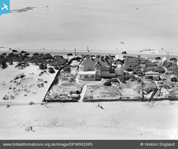
EPW061365 ENGLAND (1939). Storm House on Banks Road, Sandbanks, 1939
© Copyright OpenStreetMap contributors and licensed by the OpenStreetMap Foundation. 2026. Cartography is licensed as CC BY-SA.
Nearby Images (15)
Details
| Title | [EPW061365] Storm House on Banks Road, Sandbanks, 1939 |
| Reference | EPW061365 |
| Date | 4-June-1939 |
| Link | |
| Place name | SANDBANKS |
| Parish | |
| District | |
| Country | ENGLAND |
| Easting / Northing | 404639, 87909 |
| Longitude / Latitude | -1.9343187828506, 50.690235422343 |
| National Grid Reference | SZ046879 |
Pins
Be the first to add a comment to this image!


![[EPW061365] Storm House on Banks Road, Sandbanks, 1939](http://britainfromabove.org.uk/sites/all/libraries/aerofilms-images/public/100x100/EPW/061/EPW061365.jpg)
![[EPW061368] Storm House on Banks Road, Sandbanks, 1939](http://britainfromabove.org.uk/sites/all/libraries/aerofilms-images/public/100x100/EPW/061/EPW061368.jpg)
![[EPW061370] Storm House on Banks Road, Sandbanks, 1939](http://britainfromabove.org.uk/sites/all/libraries/aerofilms-images/public/100x100/EPW/061/EPW061370.jpg)
![[EPW061367] Storm House on Banks Road, Sandbanks, 1939](http://britainfromabove.org.uk/sites/all/libraries/aerofilms-images/public/100x100/EPW/061/EPW061367.jpg)
![[EPW061369] Storm House on Banks Road, Sandbanks, 1939](http://britainfromabove.org.uk/sites/all/libraries/aerofilms-images/public/100x100/EPW/061/EPW061369.jpg)
![[EPW061366] Houses on Banks Road, Sandbanks, 1939](http://britainfromabove.org.uk/sites/all/libraries/aerofilms-images/public/100x100/EPW/061/EPW061366.jpg)
![[EPW061352] Houses on Banks Road, Sandbanks, 1939](http://britainfromabove.org.uk/sites/all/libraries/aerofilms-images/public/100x100/EPW/061/EPW061352.jpg)
![[EPW061349] Houses on Banks Road, Sandbanks, 1939](http://britainfromabove.org.uk/sites/all/libraries/aerofilms-images/public/100x100/EPW/061/EPW061349.jpg)
![[EPW061354] Houses on Banks Road, Sandbanks, 1939](http://britainfromabove.org.uk/sites/all/libraries/aerofilms-images/public/100x100/EPW/061/EPW061354.jpg)
![[EPW061353] Houses on Banks Road, Sandbanks, 1939](http://britainfromabove.org.uk/sites/all/libraries/aerofilms-images/public/100x100/EPW/061/EPW061353.jpg)
![[EPW061351] Houses along Banks Road, Sandbanks, 1939](http://britainfromabove.org.uk/sites/all/libraries/aerofilms-images/public/100x100/EPW/061/EPW061351.jpg)
![[EPW061350] Houses on Banks Road, Sandbanks, 1939](http://britainfromabove.org.uk/sites/all/libraries/aerofilms-images/public/100x100/EPW/061/EPW061350.jpg)
![[EAW010739] Sandbanks, Brownsea Island and the Harour, Poole, from the south-east, 1947](http://britainfromabove.org.uk/sites/all/libraries/aerofilms-images/public/100x100/EAW/010/EAW010739.jpg)
![[EPW041054] The Pavilion and Recreation Ground, Sandbanks, 1933](http://britainfromabove.org.uk/sites/all/libraries/aerofilms-images/public/100x100/EPW/041/EPW041054.jpg)
![[EPW041053] The Sandbanks peninsula, Sandbanks, from the east, 1933. This image has been produced from a copy-negative.](http://britainfromabove.org.uk/sites/all/libraries/aerofilms-images/public/100x100/EPW/041/EPW041053.jpg)