
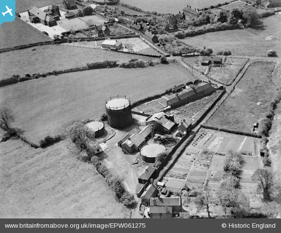
EPW061275 ENGLAND (1939). The town Gas Works, Dawley, 1939
© Copyright OpenStreetMap contributors and licensed by the OpenStreetMap Foundation. 2026. Cartography is licensed as CC BY-SA.
Nearby Images (5)
EPW061275

EPW061277

EPW061276

EPW061279

EPW061278

Details
| Title | [EPW061275] The town Gas Works, Dawley, 1939 |
| Reference | EPW061275 |
| Date | 31-May-1939 |
| Link | |
| Place name | DAWLEY |
| Parish | GREAT DAWLEY |
| District | |
| Country | ENGLAND |
| Easting / Northing | 368228, 307057 |
| Longitude / Latitude | -2.4697933584213, 52.659954134265 |
| National Grid Reference | SJ682071 |
Pins

dawleymon |
Saturday 2nd of August 2014 01:34:45 PM |
User Comment Contributions
The building in the top left of the shot is Pool Hill School, which burnt down in the 1970's. |
Alun |
Thursday 10th of October 2013 11:04:48 AM |