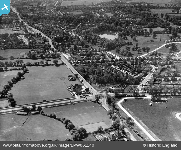
EPW061140 ENGLAND (1939). Canons Corner and environs, Canons Park, 1939
© Copyright OpenStreetMap contributors and licensed by the OpenStreetMap Foundation. 2026. Cartography is licensed as CC BY-SA.
Details
| Title | [EPW061140] Canons Corner and environs, Canons Park, 1939 |
| Reference | EPW061140 |
| Date | 30-May-1939 |
| Link | |
| Place name | CANONS PARK |
| Parish | |
| District | |
| Country | ENGLAND |
| Easting / Northing | 518373, 192645 |
| Longitude / Latitude | -0.28994553166219, 51.619693943372 |
| National Grid Reference | TQ184926 |
Pins

Lee P |
Thursday 26th of November 2015 09:56:52 AM | |

Lee P |
Thursday 26th of November 2015 09:38:50 AM | |

colsouth111 |
Monday 28th of October 2013 07:22:11 PM | |
Used as cricket pitch by Edgware Secondary Modern School 1950's and 1960's. |

ken |
Wednesday 12th of August 2015 02:31:04 PM |

colsouth111 |
Monday 28th of October 2013 07:21:03 PM | |

colsouth111 |
Monday 28th of October 2013 07:20:06 PM |


![[EPW061140] Canons Corner and environs, Canons Park, 1939](http://britainfromabove.org.uk/sites/all/libraries/aerofilms-images/public/100x100/EPW/061/EPW061140.jpg)
![[EAW027664] A Hunting Aerosurveys DH.89A Rapide (G-AEAL) in flight over the Edgwarebury Park area, Edgware, from the south-west, 1949](http://britainfromabove.org.uk/sites/all/libraries/aerofilms-images/public/100x100/EAW/027/EAW027664.jpg)
![[EPW034617] Housing development around Green Lane, Edgware, from the south-west, 1930](http://britainfromabove.org.uk/sites/all/libraries/aerofilms-images/public/100x100/EPW/034/EPW034617.jpg)
![[EPW034616] Housing development around Green Lane, Edgware, from the south-west, 1930](http://britainfromabove.org.uk/sites/all/libraries/aerofilms-images/public/100x100/EPW/034/EPW034616.jpg)