
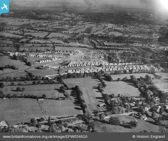
EPW034616 ENGLAND (1930). Housing development around Green Lane, Edgware, from the south-west, 1930
© Copyright OpenStreetMap contributors and licensed by the OpenStreetMap Foundation. 2026. Cartography is licensed as CC BY-SA.
Nearby Images (4)
EPW034616

EPW034617

EAW027664
 in flight over the Edgwarebury Park area, Edgware, from the south-west, 1949")
EPW061140

Details
| Title | [EPW034616] Housing development around Green Lane, Edgware, from the south-west, 1930 |
| Reference | EPW034616 |
| Date | 16-October-1930 |
| Link | |
| Place name | EDGWARE |
| Parish | |
| District | |
| Country | ENGLAND |
| Easting / Northing | 518620, 192648 |
| Longitude / Latitude | -0.28637799114726, 51.619668895643 |
| National Grid Reference | TQ186926 |
Pins

Lee P |
Thursday 26th of November 2015 09:11:08 AM |