
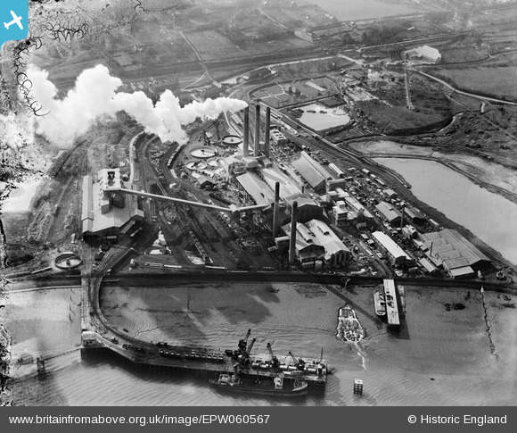
EPW060567 ENGLAND (1939). The Kent Portland Cement Works and Jetty, Stone, 1939. This image has been produced from a damaged negative.
© Copyright OpenStreetMap contributors and licensed by the OpenStreetMap Foundation. 2026. Cartography is licensed as CC BY-SA.
Nearby Images (14)
EPW060567

EPW060571

EPW060562

EPW060566

EPW060570

EPW060565

EPW060960

EPW060563

EPW060564

EPW017653

EPW060561

EPW060569

EPW060568

EPW060602

Details
| Title | [EPW060567] The Kent Portland Cement Works and Jetty, Stone, 1939. This image has been produced from a damaged negative. |
| Reference | EPW060567 |
| Date | 27-February-1939 |
| Link | |
| Place name | STONE |
| Parish | STONE |
| District | |
| Country | ENGLAND |
| Easting / Northing | 557711, 175266 |
| Longitude / Latitude | 0.27013605522483, 51.453889231592 |
| National Grid Reference | TQ577753 |
Pins

Dylan Moore |
Wednesday 26th of November 2014 12:51:32 PM | |
|
Dylan Moore |
Wednesday 12th of February 2014 04:08:52 PM | |
|
Dylan Moore |
Wednesday 12th of February 2014 04:07:58 PM | |
|
Dylan Moore |
Wednesday 12th of February 2014 04:06:13 PM | |
|
Dylan Moore |
Saturday 15th of June 2013 10:20:30 AM | |
|
Dylan Moore |
Saturday 15th of June 2013 10:12:05 AM | |
|
Dylan Moore |
Saturday 15th of June 2013 10:11:08 AM |