
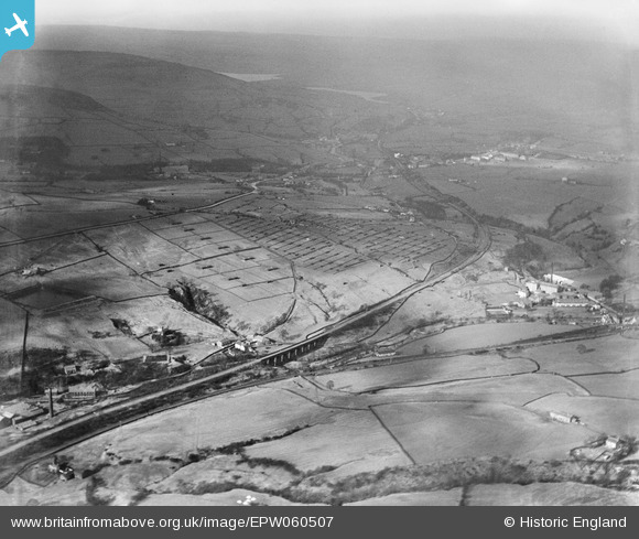
EPW060507 ENGLAND (1939). Railway viaduct near Lumb Hall, Poultry Farm at Kenyon Clough and environs, Helmshore, from the south-east, 1939
© Copyright OpenStreetMap contributors and licensed by the OpenStreetMap Foundation. 2026. Cartography is licensed as CC BY-SA.
Nearby Images (5)
EPW060507

EPW060508

EPW060501

EPW060502

EPW060505

Details
| Title | [EPW060507] Railway viaduct near Lumb Hall, Poultry Farm at Kenyon Clough and environs, Helmshore, from the south-east, 1939 |
| Reference | EPW060507 |
| Date | 9-February-1939 |
| Link | |
| Place name | HELMSHORE |
| Parish | |
| District | |
| Country | ENGLAND |
| Easting / Northing | 378857, 420006 |
| Longitude / Latitude | -2.3201000466983, 53.67586479469 |
| National Grid Reference | SD789200 |
Pins

wadey |
Monday 24th of November 2014 03:29:15 PM | |
|
wadey |
Monday 24th of November 2014 02:10:22 PM | |
|
wadey |
Monday 24th of November 2014 02:09:30 PM | |
|
wadey |
Monday 24th of November 2014 02:09:00 PM | |
|
wadey |
Monday 24th of November 2014 02:08:26 PM |