
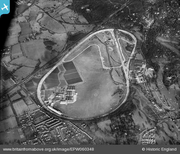
EPW060348 ENGLAND (1939). Brooklands Motor Course and environs, Brooklands, 1939
© Copyright OpenStreetMap contributors and licensed by the OpenStreetMap Foundation. 2026. Cartography is licensed as CC BY-SA.
Nearby Images (4)
EPW060348

EAW003347

EPW060350

EPW044007
 owned by Germ Lubricants Ltd flying over Brooklands Airfield and Motor Course, Weybridge, 1934")
Details
| Title | [EPW060348] Brooklands Motor Course and environs, Brooklands, 1939 |
| Reference | EPW060348 |
| Date | 12-January-1939 |
| Link | |
| Place name | BROOKLANDS |
| Parish | |
| District | |
| Country | ENGLAND |
| Easting / Northing | 506628, 162275 |
| Longitude / Latitude | -0.4687216451957, 51.349037250758 |
| National Grid Reference | TQ066623 |
Pins

Paolo |
Tuesday 27th of June 2023 03:27:56 PM | |
|
richy |
Monday 18th of May 2015 05:04:00 PM | |
|
richy |
Monday 18th of May 2015 05:03:03 PM | |
|
richy |
Monday 18th of May 2015 05:02:08 PM | |
|
Where's Canning Town? |
Friday 14th of March 2014 09:18:34 PM | |

Class31 |
Wednesday 26th of February 2014 11:28:32 AM | |
|
Class31 |
Wednesday 26th of February 2014 11:20:11 AM | |
|
Class31 |
Wednesday 26th of February 2014 11:00:32 AM | |
|
Class31 |
Wednesday 26th of February 2014 10:53:45 AM | |
|
Class31 |
Wednesday 26th of February 2014 10:53:22 AM | |
|
flubber |
Tuesday 26th of November 2013 12:05:34 AM | |
|
Ian |
Thursday 4th of July 2013 02:48:26 PM |