
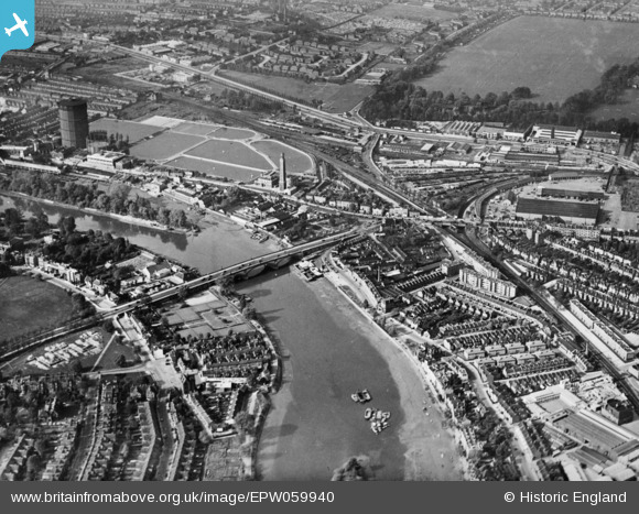
EPW059940 ENGLAND (1938). Kew Bridge and environs, Brentford, 1938. This image has been produced from a copy-negative.
© Copyright OpenStreetMap contributors and licensed by the OpenStreetMap Foundation. 2026. Cartography is licensed as CC BY-SA.
Nearby Images (7)
EPW059940

EPW001717

EPW059344

EAW042755

EPW057062

EAW042756
, Kew, 1952. This image has been produced from a damaged negative.")
EPW001669

Details
| Title | [EPW059940] Kew Bridge and environs, Brentford, 1938. This image has been produced from a copy-negative. |
| Reference | EPW059940 |
| Date | 15-October-1938 |
| Link | |
| Place name | BRENTFORD |
| Parish | |
| District | |
| Country | ENGLAND |
| Easting / Northing | 518988, 177953 |
| Longitude / Latitude | -0.28603701926336, 51.487506871477 |
| National Grid Reference | TQ190780 |
Pins

Leslie B |
Monday 23rd of May 2022 03:02:19 PM | |

Class31 |
Tuesday 2nd of June 2015 10:46:45 AM |
