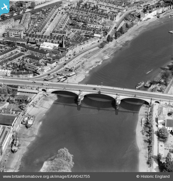
EAW042755 ENGLAND (1952). Kew Bridge, Brentford, 1952
© Copyright OpenStreetMap contributors and licensed by the OpenStreetMap Foundation. 2026. Cartography is licensed as CC BY-SA.
Nearby Images (8)
Details
| Title | [EAW042755] Kew Bridge, Brentford, 1952 |
| Reference | EAW042755 |
| Date | 29-April-1952 |
| Link | |
| Place name | BRENTFORD |
| Parish | |
| District | |
| Country | ENGLAND |
| Easting / Northing | 519007, 177865 |
| Longitude / Latitude | -0.285793134856, 51.486711884606 |
| National Grid Reference | TQ190779 |


![[EAW042755] Kew Bridge, Brentford, 1952](http://britainfromabove.org.uk/sites/all/libraries/aerofilms-images/public/100x100/EAW/042/EAW042755.jpg)
![[EPW057062] Kew Bridge and Strand-on-the-Green, Gunnersbury, from the south-west, 1938](http://britainfromabove.org.uk/sites/all/libraries/aerofilms-images/public/100x100/EPW/057/EPW057062.jpg)
![[EAW042756] Kew Bridge (site of), Kew, 1952. This image has been produced from a damaged negative.](http://britainfromabove.org.uk/sites/all/libraries/aerofilms-images/public/100x100/EAW/042/EAW042756.jpg)
![[EPW059940] Kew Bridge and environs, Brentford, 1938. This image has been produced from a copy-negative.](http://britainfromabove.org.uk/sites/all/libraries/aerofilms-images/public/100x100/EPW/059/EPW059940.jpg)
![[EPW001717] Kew Bridge and Kew Bridge Station, Kew, 1920](http://britainfromabove.org.uk/sites/all/libraries/aerofilms-images/public/100x100/EPW/001/EPW001717.jpg)
![[EPW059344] Kew Bridge and environs, Brentford, 1938](http://britainfromabove.org.uk/sites/all/libraries/aerofilms-images/public/100x100/EPW/059/EPW059344.jpg)
![[EPW001669] Kew Bridge and Kew Bridge Water Works, Brentford, 1920. This image has been produced from a print.](http://britainfromabove.org.uk/sites/all/libraries/aerofilms-images/public/100x100/EPW/001/EPW001669.jpg)
![[EPW022565] Kew Bridge and Kew Green, Kew, 1928](http://britainfromabove.org.uk/sites/all/libraries/aerofilms-images/public/100x100/EPW/022/EPW022565.jpg)

