
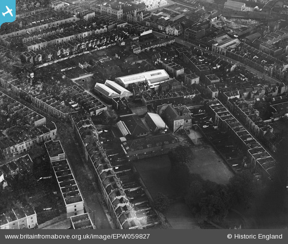
EPW059827 ENGLAND (1938). St Paul's National School and environs, Bristol, 1938
© Copyright OpenStreetMap contributors and licensed by the OpenStreetMap Foundation. 2026. Cartography is licensed as CC BY-SA.
Nearby Images (6)
EPW059827

EPW059825

EPW059826

EPW059823

EPW059828

EPW012228

Details
| Title | [EPW059827] St Paul's National School and environs, Bristol, 1938 |
| Reference | EPW059827 |
| Date | 1-October-1938 |
| Link | |
| Place name | BRISTOL |
| Parish | |
| District | |
| Country | ENGLAND |
| Easting / Northing | 359617, 173810 |
| Longitude / Latitude | -2.5813470795397, 51.461334222102 |
| National Grid Reference | ST596738 |
Pins

Cai |
Saturday 18th of April 2015 04:32:47 PM | |
|
Cai |
Saturday 18th of April 2015 04:32:04 PM | |
|
ChurchCrawler |
Saturday 5th of July 2014 06:28:30 PM | |

Class31 |
Monday 10th of March 2014 04:37:16 PM | |
|
Class31 |
Monday 10th of March 2014 04:36:06 PM | |
|
Class31 |
Monday 10th of March 2014 04:35:30 PM | |
|
Class31 |
Monday 10th of March 2014 04:35:08 PM | |
|
Class31 |
Monday 10th of March 2014 04:34:24 PM |