
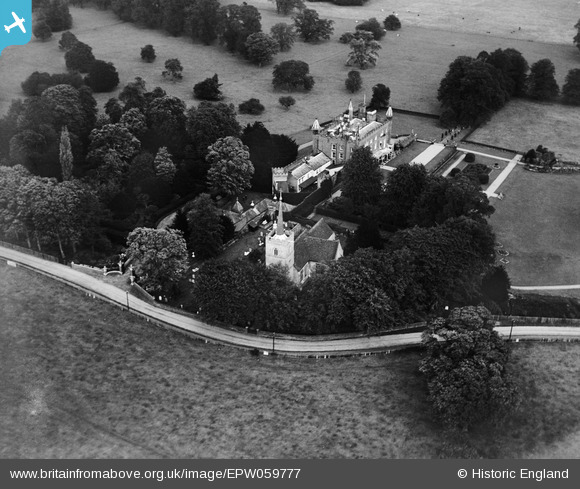
EPW059777 ENGLAND (1938). St Dunstan's Church and Hunsdon House, Hunsdon, 1938
© Copyright OpenStreetMap contributors and licensed by the OpenStreetMap Foundation. 2026. Cartography is licensed as CC BY-SA.
Nearby Images (4)
EPW059777

EPW059781

EPW059778

EPW059780

Details
| Title | [EPW059777] St Dunstan's Church and Hunsdon House, Hunsdon, 1938 |
| Reference | EPW059777 |
| Date | 6-October-1938 |
| Link | |
| Place name | HUNSDON |
| Parish | HUNSDON |
| District | |
| Country | ENGLAND |
| Easting / Northing | 541809, 212716 |
| Longitude / Latitude | 0.05656977808196, 51.794643024388 |
| National Grid Reference | TL418127 |
Pins
Be the first to add a comment to this image!