
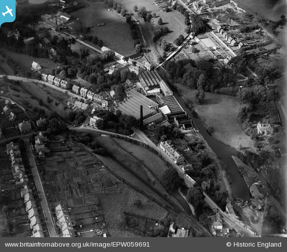
EPW059691 ENGLAND (1938). Lodgemore Woollen Mills and the Wallbridge Basin, Stroud, 1938
© Copyright OpenStreetMap contributors and licensed by the OpenStreetMap Foundation. 2026. Cartography is licensed as CC BY-SA.
Nearby Images (6)
EPW059691

EPW059690

EPW059694

EPW059692

EPW041888

EPW001174

Details
| Title | [EPW059691] Lodgemore Woollen Mills and the Wallbridge Basin, Stroud, 1938 |
| Reference | EPW059691 |
| Date | 29-October-1938 |
| Link | |
| Place name | STROUD |
| Parish | STROUD |
| District | |
| Country | ENGLAND |
| Easting / Northing | 384499, 204982 |
| Longitude / Latitude | -2.2245333918634, 51.742870324406 |
| National Grid Reference | SO845050 |
Pins

cookie |
Monday 31st of March 2014 02:48:29 PM | |
|
Toby Clempson |
Friday 8th of November 2013 11:24:36 AM | |
|
MB |
Thursday 3rd of October 2013 11:27:44 AM | |
|
MB |
Thursday 3rd of October 2013 11:26:48 AM | |
|
MB |
Thursday 3rd of October 2013 11:26:24 AM | |
|
MB |
Thursday 3rd of October 2013 11:25:40 AM | |
|
MB |
Thursday 3rd of October 2013 11:24:34 AM | |
This was the first lock on the Thames and Severn Canal, and the beginning of the canal as it leaves the Stroudwater Canal to climb the valley to Daneway and the tunnel. |
Toby Clempson |
Friday 8th of November 2013 11:26:29 AM |