
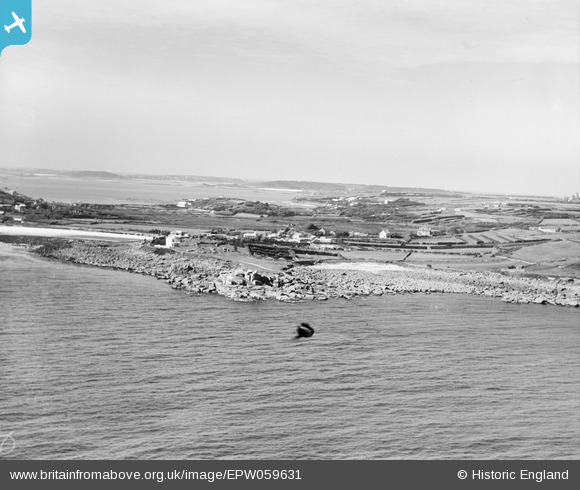
EPW059631 ENGLAND (1938). Tolman Point and Old Town, St Mary's, from the south-east, 1938
© Copyright OpenStreetMap contributors and licensed by the OpenStreetMap Foundation. 2026. Cartography is licensed as CC BY-SA.
Nearby Images (2)
EPW059631

EPW059845

Details
| Title | [EPW059631] Tolman Point and Old Town, St Mary's, from the south-east, 1938 |
| Reference | EPW059631 |
| Date | 15-September-1938 |
| Link | |
| Place name | ST MARY'S |
| Parish | ST. MARY'S |
| District | |
| Country | ENGLAND |
| Easting / Northing | 91650, 9931 |
| Longitude / Latitude | -6.2955547881643, 49.9092884702 |
| National Grid Reference | SV917099 |
Pins
Be the first to add a comment to this image!