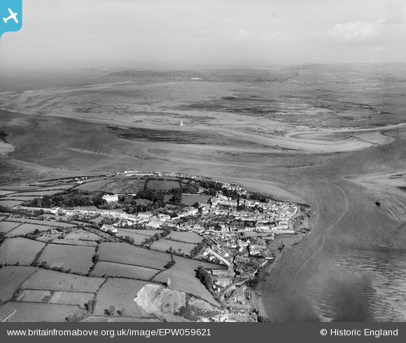
EPW059621 ENGLAND (1938). The mouth of the River Taw, Braunton Burrows and the village, Appledore, from the south, 1938
© Copyright OpenStreetMap contributors and licensed by the OpenStreetMap Foundation. 2026. Cartography is licensed as CC BY-SA.
Nearby Images (2)
EPW059621

EAW021340

Details
| Title | [EPW059621] The mouth of the River Taw, Braunton Burrows and the village, Appledore, from the south, 1938 |
| Reference | EPW059621 |
| Date | 22-September-1938 |
| Link | |
| Place name | APPLEDORE |
| Parish | NORTHAM |
| District | |
| Country | ENGLAND |
| Easting / Northing | 246397, 130136 |
| Longitude / Latitude | -4.1916777497058, 51.049469577459 |
| National Grid Reference | SS464301 |
Pins

David |
Wednesday 18th of June 2014 09:32:00 PM | |
|
David |
Wednesday 18th of June 2014 09:31:59 PM | |
|
David |
Sunday 15th of June 2014 02:25:04 PM | |
|
David |
Sunday 15th of June 2014 02:23:47 PM | |
|
jandpatupton |
Monday 4th of November 2013 04:18:05 PM |