
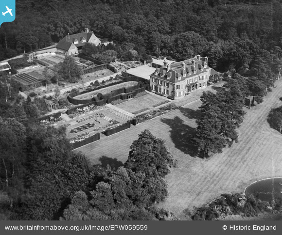
EPW059559 ENGLAND (1938). Stilemans, Munstead Heath, 1938
© Copyright OpenStreetMap contributors and licensed by the OpenStreetMap Foundation. 2026. Cartography is licensed as CC BY-SA.
Nearby Images (10)
EPW059559

EPW059560

EPW059563

EPW059228

EPW059229

EPW059234

EPW059233

EPW059561

EPW059562

EPW059232

Details
| Title | [EPW059559] Stilemans, Munstead Heath, 1938 |
| Reference | EPW059559 |
| Date | 23-September-1938 |
| Link | |
| Place name | MUNSTEAD HEATH |
| Parish | BUSBRIDGE |
| District | |
| Country | ENGLAND |
| Easting / Northing | 498804, 142091 |
| Longitude / Latitude | -0.58661983089279, 51.168995061207 |
| National Grid Reference | SU988421 |
Pins
Be the first to add a comment to this image!